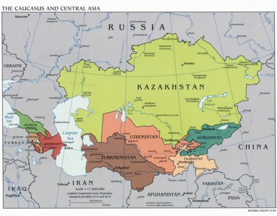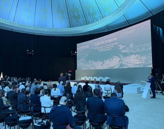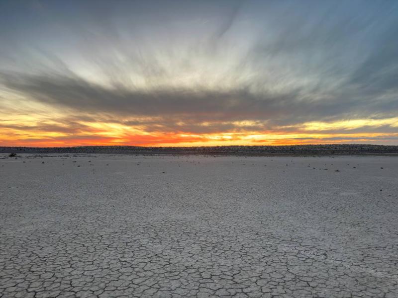
A round table was held in Tashkent on January 19 to discuss the findings of four expeditions conducted by the Scientific Information Center of the Interstate Coordination Water Commission of Central Asia (SIC ICWC) on the dried bed of the Aral Sea. These expeditions, supported by the UN Development Programme from 2019 to 2023, aimed to address the ecological challenges arising from the disappearance of the Aral Sea and the subsequent formation of the Aralkum salt desert, covering approximately 5 million hectares, with 2.9 million hectares in Uzbekistan, UNDP Uzbekistan reported.
The region poses a significant threat to the environment and the health of the local population, making it a priority to mitigate the negative consequences of the Aral Sea’s drying up and improve living conditions. The Government recognizes this urgency. On May 18, 2021, at the suggestion of the President of Uzbekistan, the UN General Assembly adopted a resolution declaring the Aral Sea region a zone of environmental innovations and technologies. Later, in January 2022, the Government of Uzbekistan adopted the Comprehensive Roadmap for the Development of the Aral Sea Region. Also, in 2018, a reforestation program was launched in the dried-up part of the Aral Sea, and today, out of 2.9 million hectares of the dried area, 1.8 million hectares are already covered with saxaul. To effectively implement further measures and ensure their sustainability, a comprehensive understanding of the current state of the environmental disaster zone based on scientific evidence is essential. Therefore, monitoring of the dried bottom was initiated, considering both natural processes of instability and intense anthropogenic pressure.
The SIC ICWC expeditions, conducted in four stages from 2019 to 2023, involved collaboration with the Scientific Center for the Aral Sea region and specialists in ecology, soil science, hydrogeology, dendrology, botany, and GIS. Encompassing a total area of 2.7 million hectares, the study spanned from Chink to the Kazakh border and from the water’s edge to the historical sea mark.
The expeditions included the assessment and classification of soil, the creation of a soil map, identification of potential salt and dust transfer areas, and the determination of soil cover formation conditions and directions. Other notable results include research on the hydrogeological situation, groundwater levels, mineralization, purpose, and usage. The expeditions also involved geobotanical descriptions of vegetation, plant herbarium collection, establishment of formation patterns, and preservation of plant cover. The dynamics of afforestation were assessed through scientific field studies.
During the round table, it was emphasized that the obtained data provide scientists with a unique opportunity to study the processes of natural landscape formation on a dried bottom. The completion of the study will enable the synthesis of data and the creation of a geoinformation system for the dried seabed, serving as a reliable foundation for future environmental innovations in the region. These efforts are geared towards establishing and preserving a natural environment conducive to human life and the well-being of flora and fauna.
Photo: UNDP Uzbekistan